The Caribbean sun rises with an almost theatrical brilliance over the northern coasts of the Dominican Republic. The turquoise water presses against the pale sand, and the warm breeze brings the smell of guava and sea salt from the dense, low forests. The ghost of a long-gone fleet still lingers along this seemingly peaceful stretch of the Atlantic. It’s also where the tragic story of Europe’s first foothold in the Americas began.
For more than five hundred years, the northern coast of the Dominican Republic – stretching from the modern-day Puerto Plata up to the mouth of the Rio Bajabonico – has guarded the location of one of the most important archaeological mysteries of early colonial times: the graves of Christopher Columbus’s lost ships from the second voyage. Few stories capture the explosive mix of ambition, shipwrecks, disease, rebellion, and political intrigue that marked Europe’s early experiments in empire better than the fate of Columbus’s earliest New World colonies, known by history as La Navidad and then La Isabela. The sea is the wreckage of human pride and failure.
Explore this landscape, and you will enter a world where myth and memory are merged, where nature continues to hide and reveal its past in a rhythm that is all its own.

A Coastline Shaped By Catastrophe
The north coast of the Dominican Republic has stunning beauty, but it is also dangerous. The sea appears calm and serene, with a palette of blues, greens and silvers. But beneath the tranquil surface lies a complex network of reefs and shifting barricades that have tested sailors for centuries. The Atlantic winds can change direction within hours and send sudden squalls to the coast.
Columbus was caught in a trap of beauty and treachery on his first voyage, the night of 24 December 1492. The crew of his flagship, Santa Maria, sank her after a misjudgment. She was drifting in the calm currents near Cap-Haitien, on the western side of Hispaniola. Columbus avoided the humiliation and loss of command because his ship did not sink instantly. This gave him the chance to blame negligence, rather than navigational error.
The sea will not always be forgiving.
A series of coastal hazards and human error would lead to a maritime catastrophe far more devastating than the Santa Maria when Columbus returned to Hispaniola one year later. He was leading his second journey with a fleet of 17 ships. A violent storm of the time scattered ships, and several were thrown to the bottom of the sea. Rumours were spread that certain vessels had been wrecked, not by the wind, but because pilots, inexperienced and unfamiliar with unfamiliar waters, misidentified reefs.
The possible resting place of these ships is somewhere on the undersea shelf that hugs the well-studied, but still mysterious, Dominican North Coast. It’s a submerged collection of wrought iron fastenings and wood, worm-eaten, with corroded metal anchors. This could one day change the history of the Atlantic colonies.
La Isabela – A Colony Built on Sand
The sea may hold the remains of the fleet that was lost, but the land still holds the skeletons of a dream that never came true. La Isabela is located about 50 km east of Puerto Plata. It was the first permanent European settlement to be established in the Americas by Columbus.
Standing on the wide terrace of the coastal resort, you can see the same seascape as the fleet would have seen upon arrival: jagged headlands that jut into the emerald-green sea, a thin fog rising from the waves, and distant palm fronds vibrating with the wind. Where the admiral imagined fertile lands, prosperous ports and gold-rich riverbeds, the ground tells a completely different story today.
La Isabela’s curse began at its conception. The landscape that looked so inviting on arrival – gentle hills rolling into the ocean, freshwater streams cutting across the forest – was misleading when settled. The soil wasn’t ideal for European crops. In dry months, freshwater sources became brackish. The harbour, Columbus’s dream of a bustling Atlantic Gateway, was choked by reefs that were too shallow for larger ships.
The climate also brought with it waves of fever, which sickened the colonists almost instantly. The Europeans in the 15th century were not familiar with malaria and dysentery. They spread quickly. The settlement was exposed to all the force of the Atlantic storms. Structures built with European-style wood buckled under the weight.
The outlines of Columbus’s stone house, storehouses and church are visible today as pale scars in the ground. The foundations are marked with interpretive signs, but the most powerful emotional impact is simply being there. Feeling the hot air blow over the stones, and realising just how isolated and fragile this place was, can be felt by anyone.
The colony’s failure is primarily due to geography. Columbus’s builders tried to impose European shapes where Taino villages had been integrated into the land, using breezy, elevated buildings to counter humidity and planting crops that were adapted to Caribbean soils. Instead of learning from the environment, they fought it. The land ultimately won.
Clues Hidden Beneath The Waves
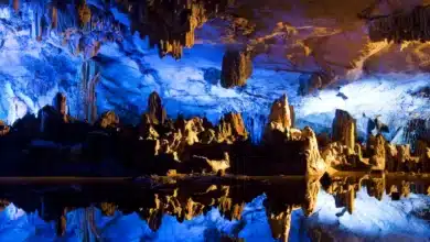
La Isabela is exposed to the sun, but the story of the fleet that was lost lies hidden beneath the surface. Marine archaeologists have described the geology of the shelf as a battleground: canyons and sand channels. Coral crowns and sudden depressions can swallow a ship and preserve it over centuries.
Two zones are most likely to contain wrecks:
- The shallow coral reefs near the settlements’ harbour, where ships may have hit coral during storms.
- The deeper trench offshore, where strong north currents can sweep wreckage in pockets of calm water deposition.
Divers have sometimes been able to see through the clearer waters of winter in the Dominican Republic, a phenomenon linked to changing Atlantic currents. The water turns into a shimmering mirror, revealing the contours of the seabed, which are usually hidden by sand.
Explorations have uncovered clusters of wrought iron nails, wood fragments, ceramics from early Europe, and cannonballs that match the composition of Iberian metalwork of the late 15th century. No ship has yet been identified as being one of Columbus’s lost vessels.
The extreme degradation of timber in tropical waters is a major challenge. Ship timbers will decay rapidly unless they are buried in anaerobic pockets of sand. It is also difficult to distinguish wreckage from Columbus’s second voyage, when more ships were lost, from debris left behind by colonial ships of three centuries later.
Every field season still brings fresh clues. Magnetometers and underwater scanners have detected iron concentrations that may indicate ship fittings. The seafloor is a palimpsest of shipwrecks and shifting sands. It’s a text that can only be read by geography intuition.
The Human Geography of Survival
The human geography of this region is just as important. While wrecks and ruins are the most obvious traces of Columbus, the story of his legacy lies in its human geography. The arrival of Europeans radically changed the population, power and culture of Hispaniola.
For centuries, the Taino people who lived on the northern coasts have organised their settlements around rivers and coastal plains. Their spatial patterns were closely tied to geography, including access to cultivated grounds, fishing grounds, trade routes, and other resources. These communities were dispersed and, in some cases, forced to relocate when Columbus arrived.
Place names like Bajabonico and Yasica along the coast, which predate European cartography, echo Taino linguistic roots. Local oral traditions mention ancient Taino paths that led inland from coastal areas, which were used to travel between villages or ceremonial sites. Spanish cartographers remapped the world but did not completely erase its geographical foundations.
The failure of La Isabela and its eventual abandonment have allowed for some natural and human systems to re-establish themselves. The cleared land was slowly reclaimed by forests. In the interior valleys of the region, indigenous agricultural practices re-emerged. Columbus’ settlement was crumbling by the time he left the island, under a cloud of political accusations.
The ruins of La Isabela in the Dominican Republic and the search to find the lost fleet are focal points of a larger reflection on the country: a reflection that acknowledges the trauma of the first contact and its complexity.
Today’s Landscape: Memory Carved on Land and Sea
Looking out to the horizon from the cliffs above La Isabela, one can see a geography of memory. Wind patterns that frustrated navigators in the fifteenth century still create waves. The reefs that tore the wooden hulls open remain unchanged. Fishermen with weathered boats navigate the same waters as Columbus, but they are much more aware of their moods.
The tourism industry has brought a new lease of life to the area, but many visitors are more interested in exploring the rich history of the region than in its beaches and resorts. In partnership with archaeologists, the Dominican government has created educational paths, underwater heritage zones and museum exhibits to help interpret history through geography, rather than myth.
Divers are particularly drawn to the mystery surrounding the lost ships. The divers describe diving into the blue-green depths, where beams of sunlight flicker over coral-rimmed canyons. Only their bubbles and distant surf rumbles can be heard. There may be remnants of the ship that changed the course of history buried somewhere in that vast labyrinth of water.

The Continuing Search
It is not just an archaeological search, but a dialogue between present and past. Each new expedition examines the coastline as a living document and asks how storms, currents, trade winds, erosion, and other factors have affected the fate of wooden vessels long gone from human sight.
Future research is likely to integrate:
- An advanced seabed map using side-scan to detect anomalies beneath layers of sand.
- Sediment Coring is used to identify layers of sediment that could correspond with shipwrecks.
- DNA Analysis of Timbers could identify the species of wood and link it to Iberian shipbuilding techniques.
- Reconstructions of climate shed light on the exact weather patterns that led some vessels to their demise.
Oceanographers have noted that the sea reveals its secrets very slowly. The north coast of the Dominican Republic is a place where time seems to be unusually patient. Every storm changes the underwater landscape, and every calm season shows new traces of the past. The ocean could eventually give up what it has been holding for over five hundred years.
A Colony’s Curse: A Coast’s Enduring Tale
The title “Columbus’s Cursed Colony” captures an inherent truth in the geography. The land was resistant to European ambitions. Climate undermined European health. The sea punished European vessels. This resistance is what has preserved much of the history for us today.
The colony’s curses were not supernatural, but rather environmental, geographical, and cultural. A misunderstanding of tropical ecosystems. Failure to understand the currents. Refusing to listen to those who know the land well.
The Dominican Republic is a country that preserves the two sides of its history: the tragic collapse of La Isabela, and the beauty of a coast as wild, powerful and unpredictable as when Columbus was here. Exploring this landscape means standing at the crossroads of continents, centuries and human ambition.
A fleet is waiting to be discovered somewhere, under the restless seas.