Many people focus on Jesus’ theology, miracles, or teachings when they think of him. We rarely consider the role geography played in shaping Jesus and his message. Cities, wilderness, political boundaries, and physical landscapes all played an important part. To understand “The First Jesus”, we need to look at the man and the landscape that shaped his life. Jesus’ story is more than a spiritual one; it is deeply rooted in Palestine of the first century.
Galilee: The Unexpected Start
Jesus was raised by Nazareth in Galilee, a small village far away from the political and spiritual epicentres in Judea and Jerusalem. Galilee, located in northern Palestine, was considered by the Judean elite to be a rural and marginalised area. The region was ethnically and racially diverse. It lay on the border of Jewish territory, and was surrounded by pagan cities such as Tyre and Sidon in the north and Decapolis in the south.
Jesus was shaped by this region in many ways. It is not an accident. Galilee was a cultural borderland where Jews and Gentiles mixed, resulting in a mingling of different cultures, languages and classes. It may explain why Jesus’ teachings were so inclusive, reaching out to Samaritans and Gentiles as well as socially marginalised people.
Nazareth was located in the hills near major trade routes such as the Via Maris or the “Way of the Sea,” which connected Egypt with Syria and passed close to the Sea of Galilee. Jesus’ youth was not isolated by his proximity to the busy trade route. Travellers, Roman Soldiers, and Merchants brought news, languages, ideas, etc. with them. Jesus’ early years were more cosmopolitan due to geography than we would think.

The Sea of Galilee – Ministry by Water
Jesus spent a large part of his public ministry around the Sea of Galilee. This freshwater lake is about 13 miles in length and 8 miles in width. The natural body of freshwater played an important role in Jesus’ life and his message. From its shores, he called his first followers — many of whom were fishermen. Along its banks, cities like Capernaum and Bethsaida grew and became centres of Jesus’ healing and preaching.
The sea was also the setting for many important events, including Jesus’ mission, walking on water, calm storms, miraculous fish catches, and the feeding of thousands. The changing lake reflected the spiritual and emotional drama of Jesus’s mission.
It was a perfect location for large crowds. The natural hills and amphitheatres that surround the lake allowed Jesus’ voice be heard by large crowds without modern amplification. Mount of Beatitudes is a location that has been identified traditionally as the Sermon on the Mount.
The Wilderness – Testing and Revelation
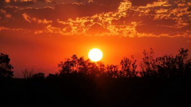
The vast, rugged Judean Wilderness lies south of Galilee. Jesus spent forty days alone in this desolate, arid landscape, between Jerusalem and the Dead Sea, facing temptation and fasting. In Jewish tradition, the wilderness was both a place of danger and revelation. The wilderness echoed Israel’s wandering after Exodus. It was a place where they could encounter God, but also face spiritual tests.
The landscape is barren, with steep limestone hills and dry riverbeds called wadis. There is little vegetation. Jesus’ survival in this wilderness connected him with the prophetic tradition that Elijah and John the Baptist both operated in similar barren landscapes. His time in the wilderness was not just a spiritual preparation, but also a journey through the desolate and broken state of the world that he came to heal.
Samaria: Geography and Division
The road connecting Galilee and Jerusalem passed through Samaria. This region was populated by Samaritans – a people group historically at odds with Jews. The Gospels show Jesus travelling to Samaria even though many Jews chose the longer, eastern route across the Jordan River to reach Jerusalem. He even interacts with Samaritans like the woman who was at the well of Sychar.
Samaria is located between Galilee, Judea, and the Mediterranean Sea. It’s a middle ground that represents a place where tensions are high on a racial and cultural level. Jesus’ interactions were radical at the time and showed his intention to overcome long-standing barriers. The geography of conflict was used as a platform for reconciliatory action.
Jerusalem, the Spiritual and Political Epicentre
Jerusalem was the most important location for Jesus’ last days. It is the capital of Judea and the home of the Second Temple. This temple is the centre of Jewish religious activity. Jerusalem, perched on the Judean hills ,was elevated both physically and metaphorically. The city of Jerusalem was a place where pilgrims would “go up”. It was a city that loomed in Jewish history, prophecy, and hope.
Jesus’ entry in the city at Passover was a time of political and geographical tension. Visitors from all over the Roman Empire flooded the city, and the Roman Governor Pontius Pilate sent extra troops to maintain order. Jesus’ actions – cleaning the temple, disputing religious leaders, and predicting the destruction of the city – challenged the power structures etched into the stones of the city.
Jerusalem’s geography was of strategic importance and difficult to conquer. The topography of Jerusalem, which includes the Mount of Olives and the Kidron valley, and Golgotha, set the scene for the Passion drama — Jesus’ arrest and crucifixion.
The Crossroads of Empires
Palestine in the first century was not an isolated region. It was at a crossroads for powerful empires, and it was a major trading route. The Roman Empire ruled the region with a mixture of local rulers, like Herod Antipas (in Galilee), and Roman governors, like Pilate (in Judea). Roman roads and military presence allowed for communication, commerce and oppression.
Jesus lived in a world that was shaped by imperial geography. Roman roads helped his message spread quickly even after his death. Herod’s port city, Caesarea Maritima, became a portal for the Gospel to reach the Gentiles. The networks that connected cities like Tarsus and Antioch and finally Rome were made up of both land and water. And the message of Jesus followed these paths for decades after his death.
The Geography of Resurrection and Expansion
After Jesus’ death, geography continued to be important. After Jesus’ death, geography continued to play a vital role. Many of his followers — who had been shaped in part by the same Galilean Hills and Jerusalem Streets — began travelling. Acts of the Apostles records this spread from Jerusalem through Judea and Samaria.
In a matter of centuries, Christianity reached North Africa, Europe and Asia Minor. In Galilee, a man from a small hill town had ignited a global movement. And geography played a powerful role in this story.
The Landscapes of Meaning
Understanding the geography behind Jesus’ life adds a new dimension to His story. He was more than a speaker, he was a man who knew places, such as the hillsides of Galilee, Samaritan routes, caves in the wilderness, temple courts and olive groves. These places were not only backdrops, but also catalysts, influencing the way he taught and the people he touched, as well as the legacy that he left.
The “First Jesus'” geography was profound. The message of God’s Kingdom came from fishing boats and mountain trails rather than palaces. As his story moved along rivers, seas and empires, the stories were shaped by their surroundings.
We are called to follow Jesus and to pay more attention to the land that surrounds us, to discover God not just in sacred texts, but also in sacred places. Jesus’ geography was not an accident. It was mission and movement — and a message– carved into the hills and valleys in history.